
An Alternate Geography
I live in the:
- Nation of Ohio
- State of Wabash
- County of Patoka-White
- City of Upper White
Let’s reverse that order, starting with Upper White and zooming out:
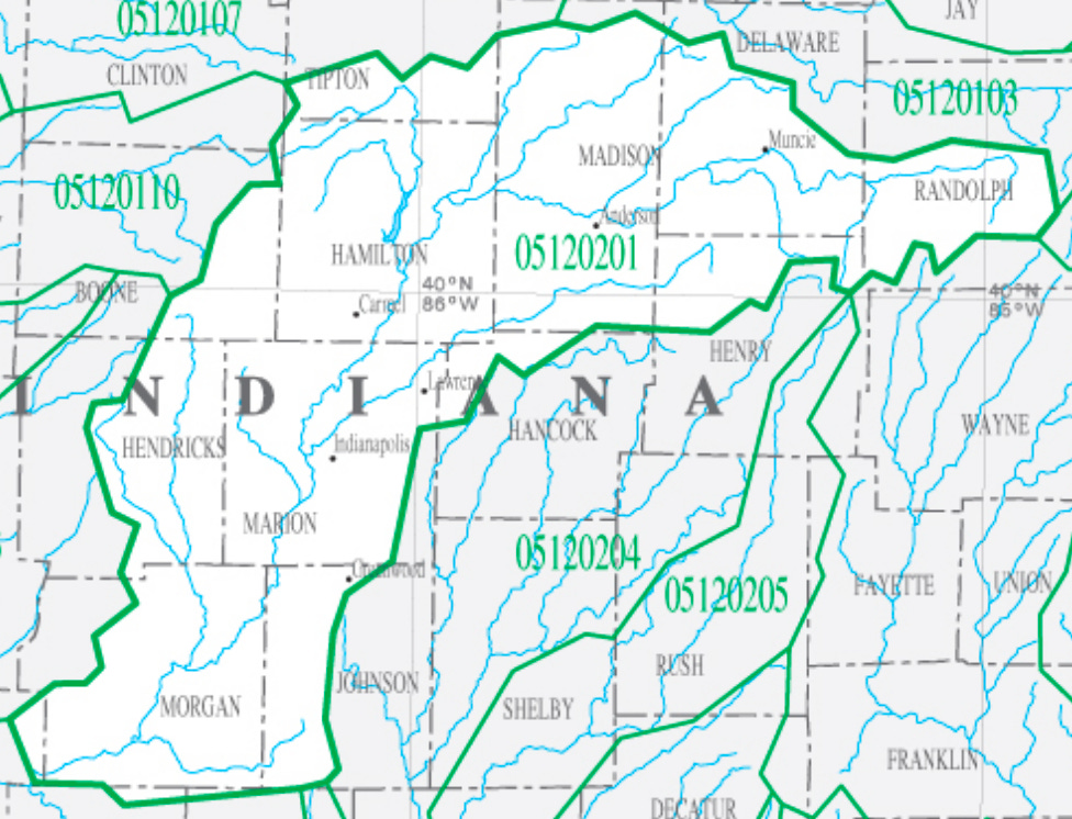
Upper White:
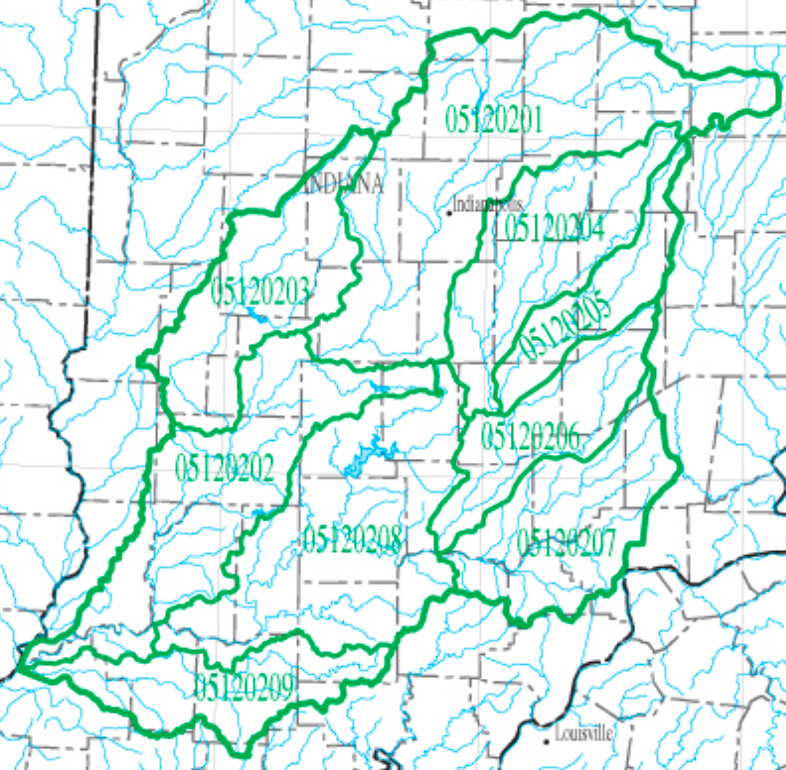
Patoka-White:
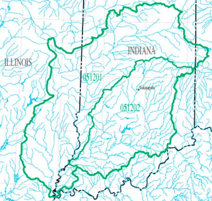
Wabash:
Ohio:
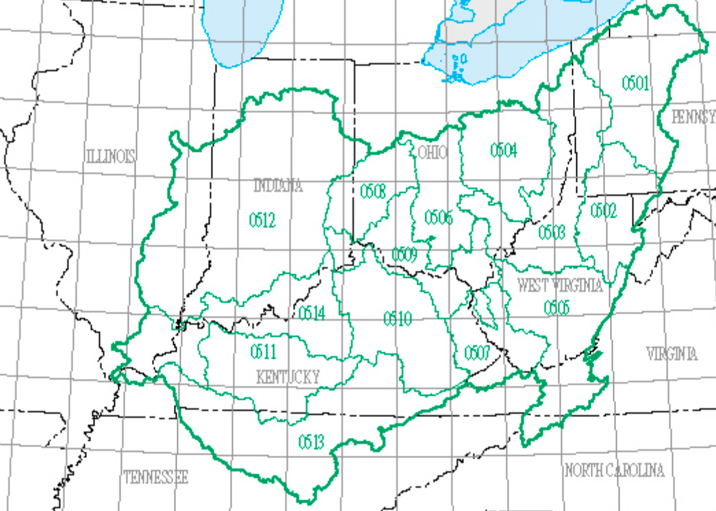
Ohio and neighbors:
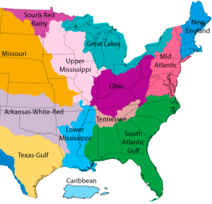
images sourced from: [https://water.usgs.gov/wsc/map_index.html](https://water.usgs.gov/wsc/map_index.html)
What are these?
These regions are “watersheds” or “drainage baisins”. They represent an area where all the water drains into one body (stream, river, lake, etc.).
In the USA, the numbers you see in the above images represent the 8-digit “HUC” or Hydrologic Unit Code. From my example, 05120201 represents Ohio (05), Wabash (12), Patoka-White (02), Upper White (01). As you can see, they are all named after the major river(s) of that region.
In addition to the 8-digit HUCs, there are also 12-digit HUCs, representing two additional layers of zoom-in and specificity. Using my proposed naming above, perhaps we could call these Townships and Neighborhoods.
What are mine?
In the USA, you can find your regions by progressively zooming in via this tool from the US Geological Survey. For each region, they also provide many linked resources.
To get even more specific, you can check your 12-digit HUC using the community water search from the EPA. This is also a great resource to see the quality of the water in your area, including the safety of swimming in it, the health of aquatic life in it, and the quality of your drinking water.
(Note: if you live outside the USA, please feel free to share in the comments how to look up watersheds where you live!)
Why does it matter?
As the saying goes: water is life. People, wildlife, and the entire ecology within a watershed are all part of the same stream of life.
In addition, ecological health is tied to financial health, and both are affected by community interactions and governance within the region. Their fate flows together.
Thus, the thought experiment of using the terms: Nation, State, County, City, Township, Neighborhood.
Political boundaries can often feel arbitrary, based on agreements or impositions that may have had very little to do with the people that actually live in the area (or were even contrary to their interests, such as in colonial situations).
But watersheds are based on shared life. Regardless of wealth, ethnicity, or other factors, people within a watershed have shared destiny.
So what?
What would it mean to think of our local watershed as our polity, our political unit?
Could we become better at seeing our neighbors as people in the same boat, rather than as enemies?
Could we more readily identify how systems are interacting?
Could it enable more long-term thinking, strategic thinking, thinking that considers not just the current moment but the impact to the financial, social, and ecological health of the region?
How is the health of your watershed? What might you do, knowing that?